Nebraskaland Magazine
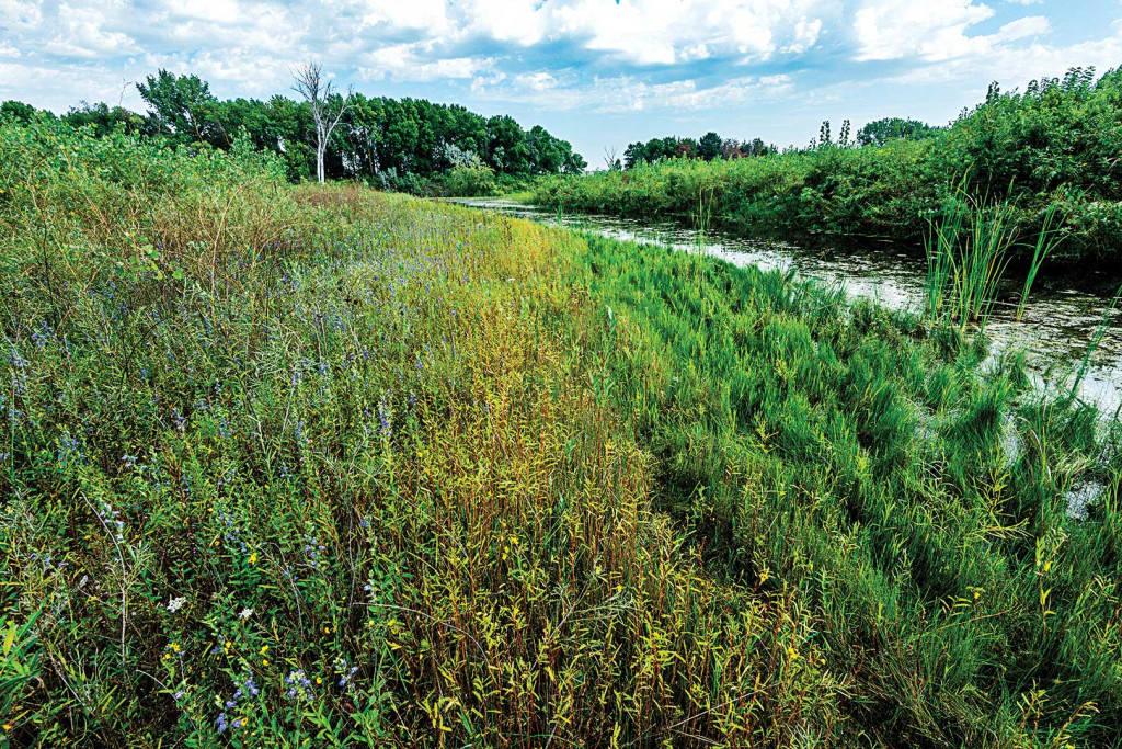
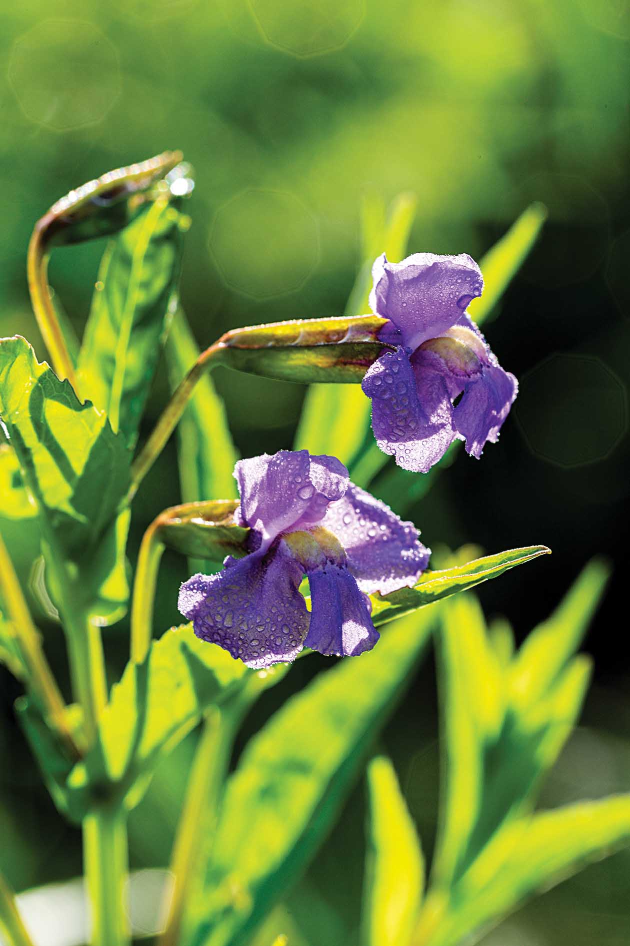
Situated along the Elkhorn River, Red Wing Wildlife Management Area is a haven for wildlife.
Enlarge
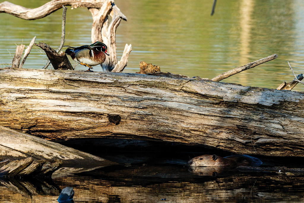
Photo by Eric Fowler, Nebraskaland Magazine
Story and photos by Eric Fowler
Dams, diversions and development have changed many rivers in Nebraska. The Elkhorn River is not one of them. It still winds its way through the northeastern Nebraska countryside, its channel slowly shifting course from year to year. During floods, those shifts can be drastic.
That is what happened sometime early in the 20th century at what would, in 1977, become Red Wing Wildlife Management Area between Clearwater and Neligh. Where the Elkhorn had taken a right turn and headed south, it took a hard left and headed north, soon turning east and eventually rejoining the main course more than a mile downstream.
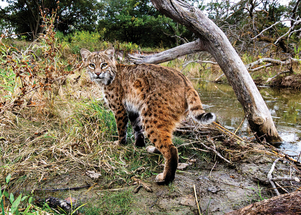
During the most recent flood in 2019, the Elkhorn changed its mind and jumped back into the channel it had abandoned a century ago. What it left behind has become a haven for wildlife, especially beaver, and a mosaic of plant species sprouting from the sand where the river once ran.
A Wild, Meandering River
The Elkhorn River is, like many in Nebraska, a meandering, alluvial river. While it has been straightened in places and had its banks armored in others, and irrigation pumps reduce its flows during the summer, it has only one small dam on its main stem, and it hasn’t been diverted for irrigation and hydropower.
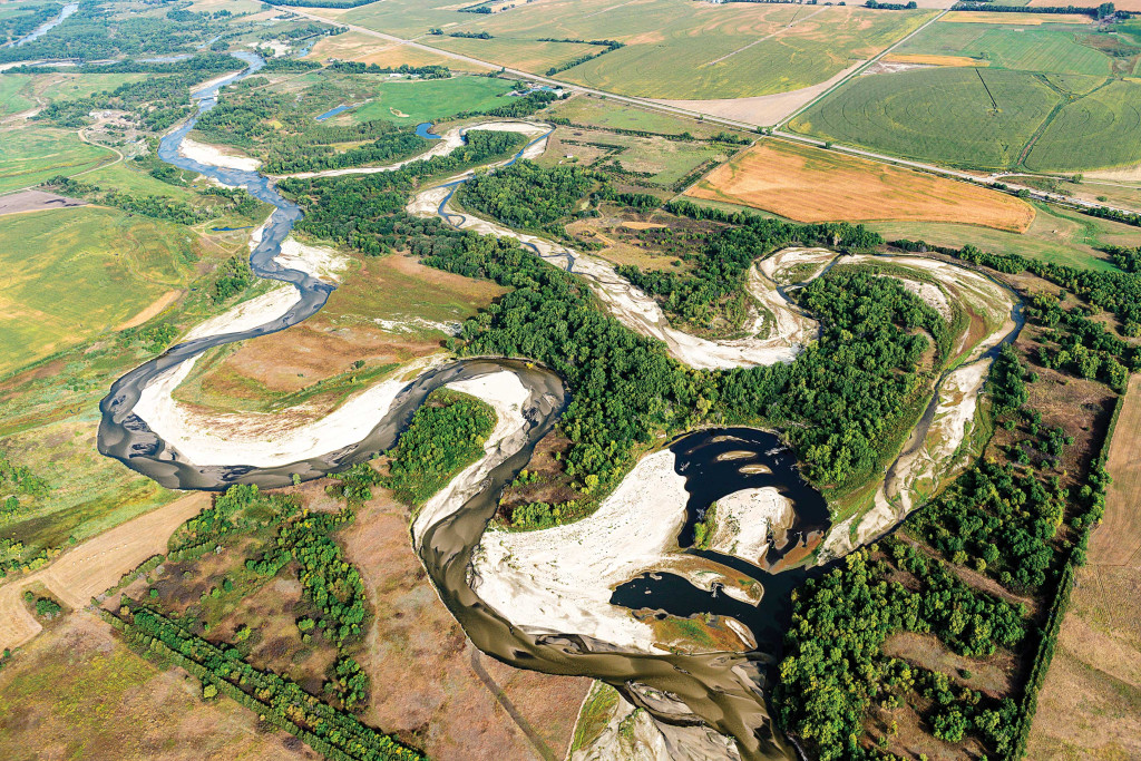
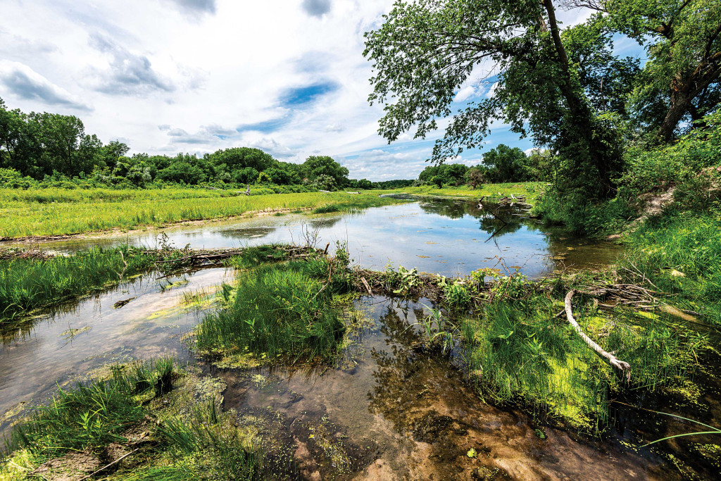
As such, it still does what wild, meandering rivers do. It winds its way like a snake through a broad floodplain, constantly chewing away at the outside of each bend, the cut bank, and depositing that sand and soil on the inside of the next bend, creating point bars. Through time, those bends become wider and the distance across the neck shorter. Eventually, during periods of high flow, the water will take a shortcut across the neck, cutting the bend off from the river and leaving oxbow lakes or marshes behind.
Fly over the river in a plane or on Google Earth, and you will see the Elkhorn River valley is littered with oxbows. Some were created many decades ago, while others are more recent. Floods in 2010 and 2019 created six cutoffs in Antelope County alone, including the one at Red Wing and another upriver at Hackberry Creek WMA, adding to the 60 or so that already existed in the county. The result is a maze of lakes, marshes, wetlands and cottonwood forests.
My first look at the changed river at Red Wing came while I was taking aerial photos of the river in September 2020. Recognizing what I was seeing was not your typical cutoff, I made several passes. The abandoned channel, 2.4 miles in length, was mostly bare sand, except for a small ribbon of flowing water. The river’s new route was only 1.5 miles long, most of it south of the 316-acre wildlife area. It looked new, with massive point bars on each bend that, like the old channel, were also bare sand.
Back at the office, I opened Google Earth and quickly saw the river’s new course was actually its old course, a path that for years had been a backwater and marsh.
When did the river turn north, I asked? Historic aerial photos did not answer the question. The first available were captured in 1938, and by then the river had been following its pre-2019 course for some time. Topographical maps weren’t available for Antelope County prior to that time either.
Merlin Bolling, a life-long resident of the Clearwater area, has seen plenty of floods in his 73 years. They come about every 10 years, he said. There were big ones in the 1940s, 1960s and 1990s. The biggest was in 2010, although there could have been others before records were kept. Bolling suspected a 1918 flood he was told about by other long-time residents caused the shift. It was after that flood, the former county road superintendent said, that a bridge was moved to the river a few miles upstream from Red Wing. The long, narrow oxbow it left behind, the one now carrying the river’s flow, became known as Horseshoe Slough.
On a visit to the Antelope County Museum to peruse old bound volumes of the Neligh Leader, I found a story on the front page of the June 7, 1918, edition of a storm that brought heavy rain, turned the streets to rivers and washed out the railroad tracks west of town in a location where only temporary repairs had been made following a previous storm. The story, short by today’s standards following a flood, focused more on damage done by wind and lightning, as though flooding was passé. Most of the news in each edition of the paper that year was coverage of World War I.
The museum had another interesting relic that may be the best clue to the river’s shift: An 1884 plat map, the oldest they have, showed the main channel of the river flowing south, where it does today, but also a smaller channel flowing north, covering part of the course it took prior to 2019. That leaves me to assume the 1918 flood caused the river to shift its flows entirely to the north channel, and also created another cutoff that remains as an oxbow marsh today.
Boots in the Sand
I set foot in the old river channel for the first time in May 2021, not knowing what I would find. Snags and sand filled most of the upper end of the old channel, which was disconnected from the river’s flows. The water that was trickling down the former course was, as the case with many Nebraska rivers, coming from groundwater below. It began flowing a few hundred yards downstream and continued throughout most of its length, with small streams connecting deeper pools next to the former cut bank or scoured around snags by the flood.
In the lower end of the wildlife area, a backwater had existed for more than 100 years in the river’s former course. Water taking this path during the 2019 flood completely reshaped this oxbow, carving away 100 yards of land from its north end and leaving massive cottonwoods sunk in a 10-acre pond dotted with sandbars surrounded by deep scour holes, a haven for wood ducks. Eventually, the river took an easterly, overland route, leaving the pond, another cutoff, behind. A row of ash trees that once stood on the east bank of the old oxbow now stands on the west bank of an island in the middle.
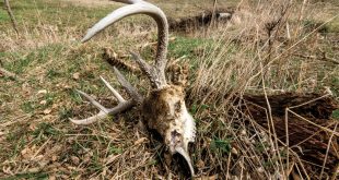
The 2-plus miles of mostly dry riverbed between was dotted with snags toppled or deposited by the floodwaters, including a few bur oaks. Beavers had only begun to get busy, having built a handful of dams that I could find no sign of in the aerial photos I had captured the previous fall. Their runs were now plainly visible wherever there was water. Rushes, grasses, cottonwoods and willows had begun to sprout from the moist, sandy bottom of the channel, and shorebirds were probing the sand for insects.
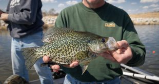
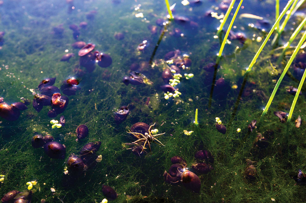
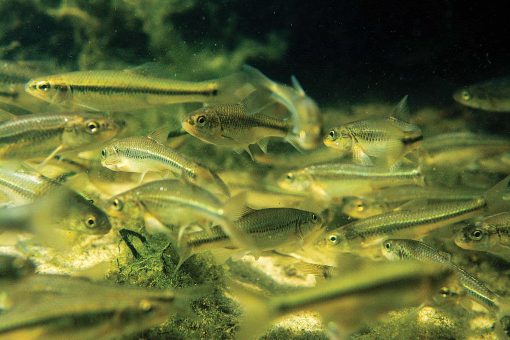
By the time I returned a month and a half later, life had exploded. Beavers had raised the level of their dams and built more, a theme that would repeat itself with each subsequent visit. In those waters, I saw more minnows than I had seen anywhere. In the deeper holes, I found sunfish, largemouth bass and schools of recently hatched bullheads. Thousands of snails crawled through the shallows. Where they were found in masses, you could hear their shells rattling against each other as they moved. Frogs thrived in the water and toads on the sand.
Thad Huenemann, rivers and streams biologist with the Game and Parks Commission, said aquatic life often explodes following a flood. What was left in the deeper pools when the water receded thrived with the nutrients carried by floodwaters.
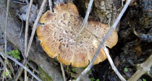
Vegetation continued to spread and flourish. Gerry Steinauer, a Game and Parks botanist, joined me on my next visit to Red Wing two weeks later. What was happening, he said, was classic river channel succession that occurs naturally in meandering rivers like the Elkhorn. The river had deposited the seeds of most of the plants sprouting from the sand. Many were flashy annuals, including lovegrasses, nutsedges and wildflowers, like beggarticks, that are adapted to growing in these ephemeral habitats. Some species preferred higher, drier spots in the sand, and others, moist soils closer to pools or the groundwater fed stream. Wetland plants, such as swamp smartweed and cattails found a home in the pools. Knee-high thickets of young plains cottonwoods and peachleaf willows were extensive. Given time, they would mature, thin themselves and become forests.
By my next visit in the fall, vegetation had covered most of the bare sand. Beaver ponds, now numbering more than 20, stretched from one dam to the next. Resident teal and wood ducks were joined by migrating mallards.
I visited Red Wing four times in 2022. By mid-summer, the old channel that had been almost entirely bare sand in early 2021 was now completely green and vegetated. Snails were still abundant, but there were far fewer minnows in the pools. When I returned late August, in the midst of extreme drought, there was little water to be found. Ponds behind the beaver dams, and the runs between them, were left high and dry. With nary a track to be found, the beavers had no doubt moved back to the river. Raccoons and other birds and mammals had likely feasted on the aquatic life as the pools dried up. Snail shells littered the bottom of dry pools.
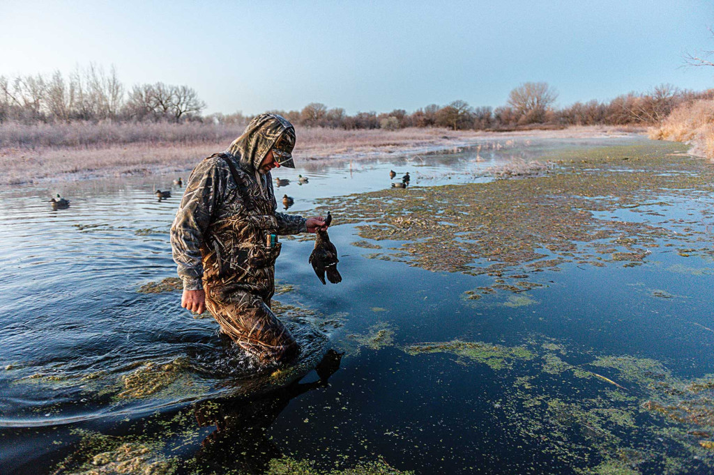
Soon after the irrigation wells were shut off for the season, groundwater levels recovered, and the water began flowing again. By November, the dams were full and water flowed between them, enough to provide a place for ducks to stop in their fall migration, and for duck hunters to deploy a decoy spread.
My only visit in 2023 came during a hot, dry spell in late July. Beaver dams still held water in the upper end of the old channel, but it was low and not flowing between dams, and I saw no fresh sign. The middle reach was dry. The lower end, however, was brimming. The influence of groundwater was obviously stronger in some reaches than others. The beavers had figured this out. The dams they built in the wet reaches, once low lines of tangled sticks, were now several feet high and covered with mud, from which trees and other vegetation grew. One in the lower end was actually keeping the water deeper in a pool on its downstream side. That pond was deeper than I was prepared to explore in my boots. I saw no minnows in the upper ponds, but I did see a few small bluegill, bass and pickerel, as well as snails. How they got into these pools that were dry a year earlier is testament to nature.
Perennial wildflowers, rushes and sedges were filling the marshes. On rich, moist soils, cottonwoods and willows were now head-high. Wildflowers and grasses were becoming more established on the higher and drier, sandy soils.
The ebbs and flows of water, and the life in it, will likely continue at Red Wing. Will the river stay in its new channel? The next flood could easily send water rushing through a low spot in the upper end of the old channel. Will it be enough that the still-wild Elkhorn will change its mind again? Or will it remain on its new course, which is actually its old course from a century ago, something that continues to amaze me.
Only time will tell.