Nebraskaland Magazine
With summer sizzling, now’s the time to hit Nebraska’s water trails for a chance to cool off.
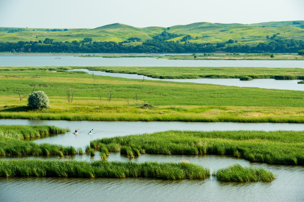
The Nebraska Game and Parks Commission features 10 water trails along stretches of the state’s well-known rivers and creeks. For the most part, these water trails — which cover more than 500 miles — are calm and perfect for kayaking, canoeing, tubing or even tanking. Choose a trail or a portion of the trail to suit your interests and skills.
Here are our top five, must-do water trails for 2022:
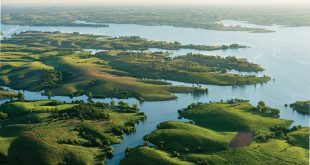
- Calamus River Water Trail: Found in northcentral Nebraska, this river flows gently from its start in the Sandhills to the Calamus Reservoir State Recreation Area. It flows even in the hottest and driest summer months because it’s fueled by groundwater from the underlying Ogallala Aquifer. The trail can be extremely meandering, with some bends curving nearly 360 degrees. Views of the gently rolling Sandhills dunes are sure to wow travelers. Though the entire trail is 56.6 miles from Nebraska Highway 7, south of Ainsworth, to Calamus Reservoir State Recreation Area, the float can be broken into smaller sections.
- Republican River Water Trail: This southwestern Nebraska water trail, a slow-flowing braided journey, offers the opportunity to see abundant wildlife. The best times to canoe are July and August, when the U.S. Army Corps of Engineers releases large quantities of water from Harlan County Lake. The trail is 49 miles from Harlan County Lake Dam to Red Cloud. Hot dry weather or intensive irrigation can affect the water levels, so be sure to check ahead.
- Platte River Water Trail: Drop in at the canoe and kayak launch at Schramm State Recreation Area and float down the Platte River to Louisville SRA — about 4.9 river miles or about one hour of float time. The difficulty of this east Nebraska water trail varies with water level and river flow, and during the summer, the navigable channel will narrow. Except at its lowest levels, the Platte’s flow is gentle, varying from 3 to 5 mph. If you want a bigger challenge, float the whole trail: about 55 miles from North Bend to Louisville SRA where a recently completed boat ramp and canoe access facility is located on the east end of the park, just before the Highway 50 bridge.
- Niobrara River Water Trail: The combination of spectacular scenery and an easy float trip have made the Niobrara River one of the top canoeing rivers in the country, drawing tens of thousands of people each year. In some spots, rock beds form short stretches of fast water, riffles and rapids (clearly marked by the Park Service), but for the most part, the flow is a lazy 2 to 3 mph along this north-central river. From the Cornell Bridge to Norden Bridge is 30.4 miles, but avid canoers and kayakers can do the entire 76-mile Niobrara National Scenic River stretch over multiple days.
- Lower Missouri River Water Trail: Most of this river is wild, appearing much like it did when Lewis and Clark traveled up it in 1804. This river winds back and forth between high banks, and those on the water will see Nebraska’s high, wooded bluffs and gorgeous exposed shale. Keep in mind, the Missouri can be 25-feet deep or more in places, so remember to wear your lifejacket. Drop in at Mulberry Bend Wildlife Management Area and end at Ponca State Park for a day trip over 22 river miles. Or plan a multiday trip along the entire 57-mile segment starting at Nebraska Tailwaters Recreation Area below Gavin’s Point Dam north of Crofton, Nebraska.
Keep in mind water levels can fluctuate with weather, as well as when it’s peak irrigation time, so be sure to check conditions on the U.S. Geological Survey streamflow site, waterdata.usgs.gov, before heading out. Also remember only the water belongs to the State of Nebraska. The riverbeds and all adjacent lands are the property of the landowner through which the water flows, so be respectful of property.
To discover detailed descriptions and tips for each of these water trails, visit OutdoorNebraska.gov/watertrails.