
By David L. Bristow, Nebraska State Historical Society
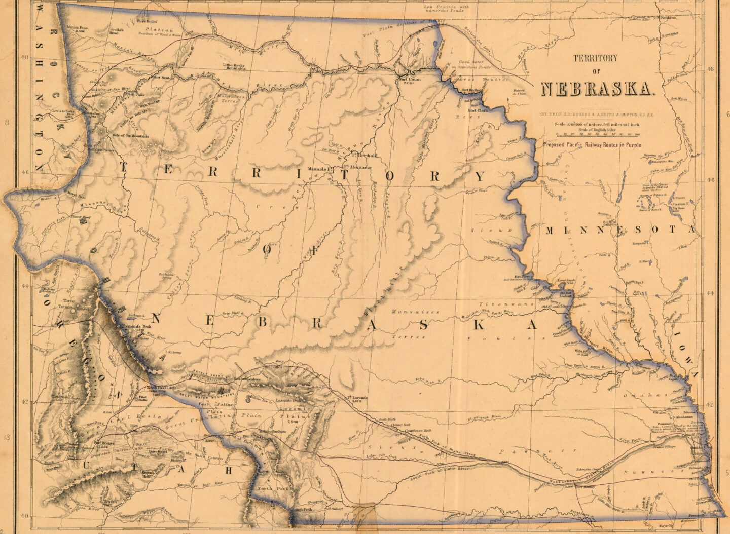
Nebraska’s land is ancient, but its boundaries are relatively new. Our borders went through several changes before the state took on its present distinctive shape. Even today, our state line has several odd quirks.
“Nebraska,” based on an Otoe name meaning “flat water,” began as the name of a river. Native tribes had their own homelands and hunting grounds, which shifted over time as various groups entered the region and competed for territory and influence. From the perspective of the expanding United States, present-day Nebraska was first considered part of Louisiana Territory, then Missouri Territory and then “unorganized territory.”
When Congress formally organized Nebraska Territory in 1854, it split off Kansas from what was originally going to be Nebraska’s southern portion. These borders were imaginary lines on paper as far as Native peoples were concerned, but the lines were the first step in a process of treaty-making, coerced land sales and dispossession in the new territory. In 1857, government surveyors began formally marking the territory’s southern boundary and dividing the land into the square-mile grid that is followed to this day by roads and fence lines.
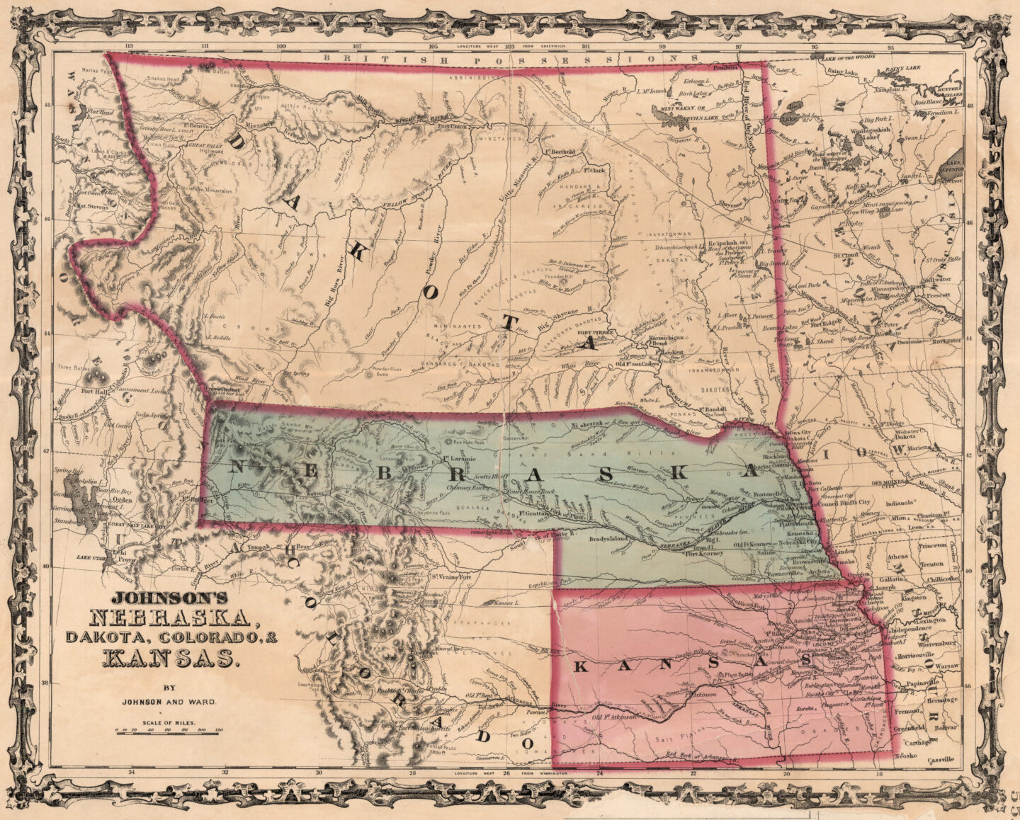
No one thought Nebraska’s expansive boundaries would be permanent. The first slices were carved away in 1861, just before the Civil War began. The founding of Colorado and Dakota Territories left Nebraska with a curiously long panhandle until its western tip was given to Idaho Territory two years later.
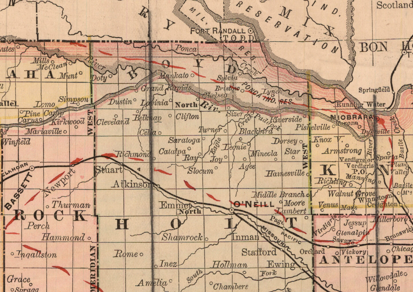
Even then, Nebraska maps from the next two decades don’t look quite right. Due to a widely copied mapmaker’s error, most maps during the first decade of statehood show several western counties that never actually existed. But the early state maps correctly showed the Niobrara and Keya Paha rivers forming part of the state’s northern boundary. Present-day Boyd County, Nebraska, was transferred from Dakota Territory in 1882.
The U.S. Supreme Court made further adjustments in an 1892 ruling that led to several border oddities. Officially, the Missouri River forms the state’s eastern border. But the river would not stay put. Its alluvial banks eroded quickly, allowing the channel to shift over time. Normally state boundaries follow these gradual changes, but in 1877 the river cut a fresh channel across a bend in the river. Suddenly, a new oxbow lake and a chunk of Iowa land lay west of the river. Nebraska and Iowa both claimed it. The court ruled that in such circumstances the state line does not change. That is why today the most direct route from downtown Omaha to Eppley Airfield passes briefly through Carter Lake, Iowa.
The same legal principle has left portions of Nebraska east of the river surrounded by Iowa — for example, at DeSoto National Wildlife Refuge — and Missouri, across from the town of Peru, and at a few other places. Meanwhile, boaters traveling the length of Lewis and Clark Lake will cross the Nebraska-South Dakota state line multiple times while following the winding channel of the Missouri River, which maintains its legal existence even while submerged in a reservoir.