
By Justin Haag
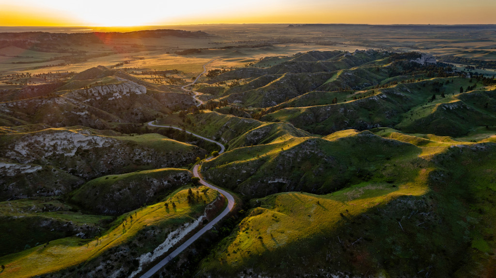
Smiley Canyon Scenic Drive has long allowed visitors to immerse themselves in the grandeur of the Pine Ridge without leaving their vehicles. The winding road has surely brought some smiles to drivers — and, yes, some frowns in its early years.
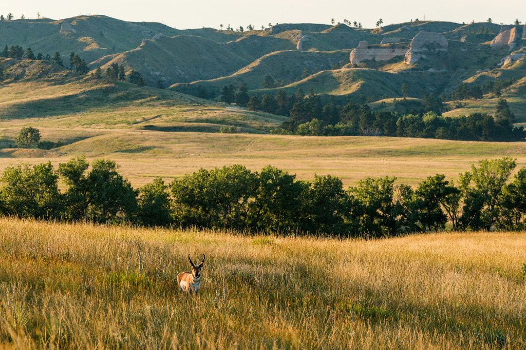
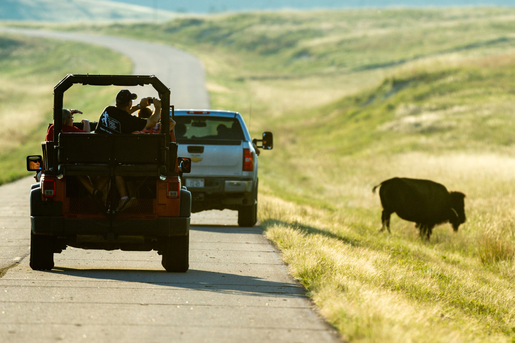
Believed to have been named for a family of Smileys that settled in the vicinity in 1893, the drive is one of the best ways to see the park’s bison herd, pronghorn, mule deer, the occasional bighorn sheep and an array of bird species. The 5½-mile paved road climbs about 900 feet from just west of Fort Robinson State Park’s central campus to the top of the ridge and its butte-top vantages.
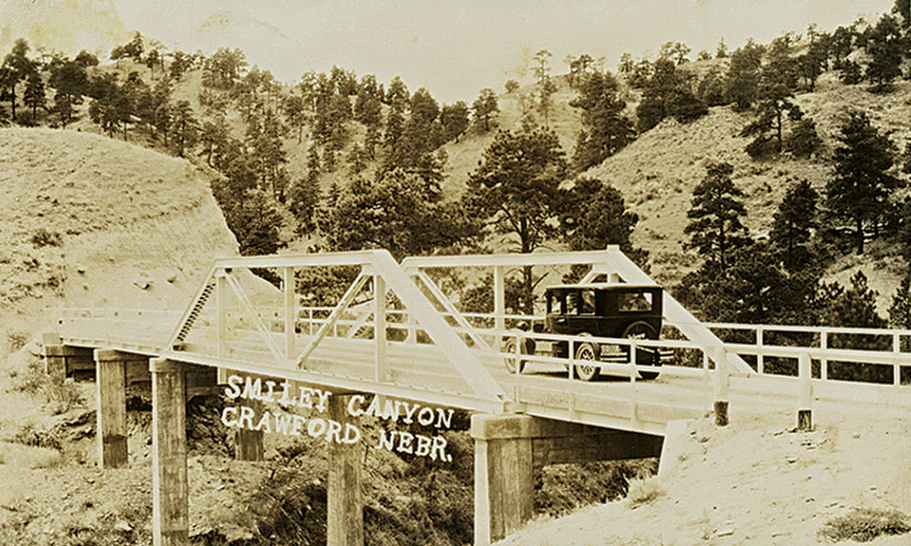
Smiley Canyon Scenic Drive has a colorful history, beginning with its planning. Few who visit the drive today realize what a challenging engineering feat it was.
The road was not only born as a way for locals to finally have a reliable route between Crawford and neighboring Harrison, but it also was part of a larger concept with excitement propagating well beyond northwestern Nebraska. The road would be a vital link for what was being billed as the Washington Highway. Named for the nation’s first president, the new automobile route would connect the Atlantic to the Pacific and provide a vital link for easterners to visit Yellowstone National Park. Today, it’s known as U.S. Highway 20.
Prior to Smiley Canyon Road’s construction, locals traveled “two miserable trails of the poorest sort which followed White River and Soldier Creek,” wrote one reporter.
In 1914, Col. Chas Thatcher, a national road expert, visited northwestern Nebraska while being tasked with marking a route for the Washington Highway. He wrote that he much preferred creating a course along Soldier Creek — long before it was the federal wilderness area of today — instead of Smiley Canyon. For reasons not found in research for this article, the latter option was chosen, though.
The road brought so much anticipation that even the arrival of road equipment in 1920 garnered headlines. Gov. Samuel McKelvie visited the construction site in 1922.
The 2-mile canyon posed great challenges for both drainage and grade. Workers used 15 tons, that’s 30,000 pounds, of TNT for the removal of 65,000 yards of material to create the road bed. About 20,000 yards of that was solid rock.
About a month after its June opening, the first of many vehicle crashes was reported in print. A man in a Paige luxury car, believed to be a retired Fort Robinson officer, “was found to have crashed into the embankment with such force as to drive the top and windshield on top of the engine, crushing the life out of the driver,” wrote the Harrison Sun.
The winding road, with its steep 7-percent grade, became especially treacherous to unfamiliar nighttime drivers who speedily approached the canyon from the relatively flat section to the west. A prime example of the road’s tendency to turn drivers’ smiles to frowns occurred in October 1963.
“Smiley Canyon, the truckers’ nemesis, claimed two trucks and a car in less than 48 hours in some sort of record the past week,” a Crawford Tribune reporter wrote, introducing a tale of the two cattle haulers that went off the road hours apart in nearly the same spot, spilling a combined 123 head yearling steers and calves. The drivers survived, but the 105 bovines that weren’t killed in the crash had to be rounded up in the rugged terrain.
After Smiley Canyon had claimed a number of lives and countless dollars in wrecked vehicles over more than four decades, today’s much less perilous route bypassing Smiley Canyon to the south was completed in 1967. Billed to be even more scenic than Smiley Canyon, the 6-mile section was named “Middleswart Pass” — a tribute to Tom Middleswart, the district road engineer from Bridgeport who designed the route.
Later in 1967, with Fort Robinson’s role as a state park in its infancy, the Game and Parks Commission filed to purchase the 640-acre tract of school land encompassing the canyon to be added to the park’s many attractions.
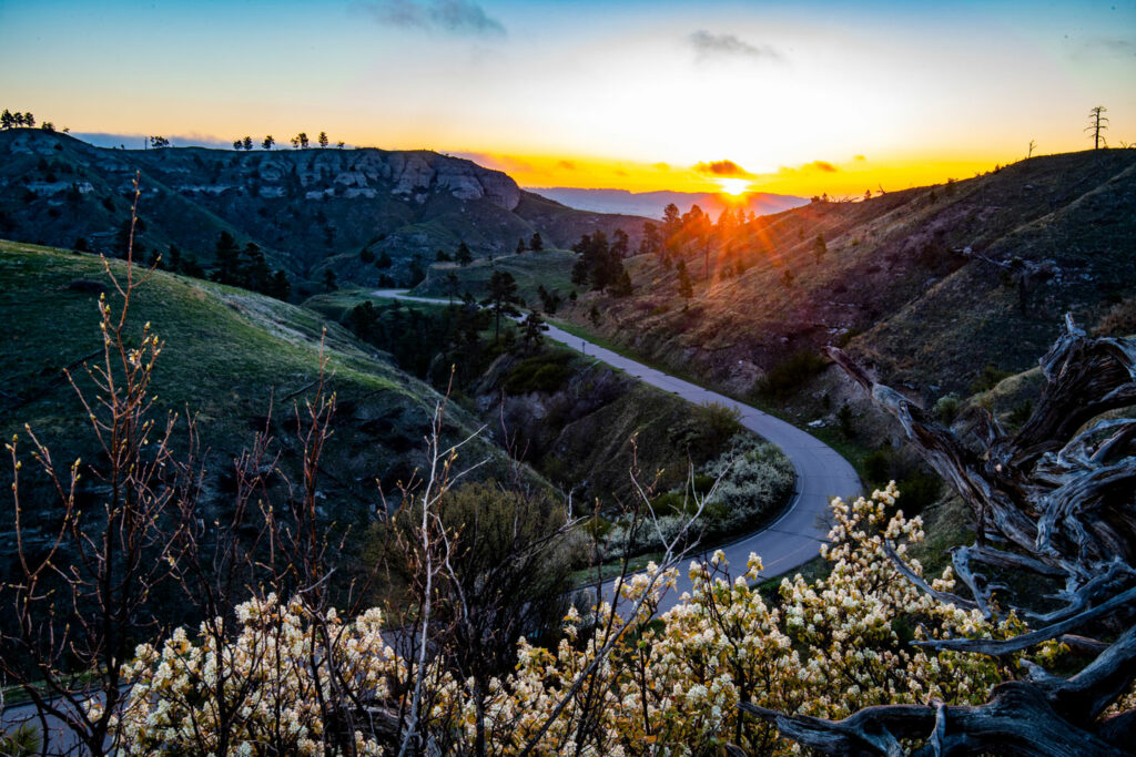
Today, the most challenging part of the road allows only one-way traffic uphill, lessening the chance of wrecks. There is also no hiking or cycling allowed in the section that goes through the bison pasture. Visitors can stop at a scenic overlook at the top of the ridge to take in the 22,000-acre park’s beauty.
Much of Smiley Canyon burned in a 1989 wildfire but retains scenic value. There are also parking areas near a historical marker and near the head of Turtle Rock Trail, a popular pathway that takes hikers, horseback riders, cyclists and the park’s Jeep rides to the top of the Cheyenne Buttes.
The dreams from the early 1900s have been realized as U.S. Highway 20 stands as the nation’s longest highway, spanning from Boston to Newport, Oregon. In Nebraska, the section between Valentine and the Wyoming border has been designated the Bridges to Buttes Scenic Byway.
Without fanfare, Smiley Canyon reached its 100th year in 2023. While it’s no longer a vital link to Yellowstone or the coasts, it’s always worth a short detour for those with a park permit — as long as they don’t let the animals and scenery distract too much attention from the road.