
By Alie Mayes, Fish and Wildlife Education Division
When was the last time you looked for shapes in the clouds? For me, it was last week as I drove the 4.5 hours home to visit my family. Almost involuntarily, I saw faces, animals and more outlined in the sky, which prompted me to imagine stories in my head about where the different creatures came from and where they were going.
This practice in imagination was much more common when I was a kid. Maybe it was the hours spent outside or at my parents’ greenhouse business. Boredom combined with the canvas of the sky can really get your mind whirling!
But making up cloud stories can be more than just a way to pass the time. The variable shapes and colors of clouds have been used as symbolism in art, music and literature. They are also used in common culture to express feelings, such cloudy moods, silver linings, etc. Clouds have long fascinated and inspired people — and for good reason. Being able to read the clouds has helped humans prepare appropriately for weather, keeping themselves safe.
The Cloud Appreciation Society encourages people to “collect” clouds by keeping a list of the various types of clouds observed. They offer an online cloud library with information about various types of cloud formations, as well as a free Cloud Spotter phone app to help people identify what they are seeing. Each cloud shape can reveal something that’s happening in the atmosphere. Here are five cloud shapes and what they can tell us:
Cirrus
Some of the highest clouds in the sky, cirrus clouds get their name from the Latin word meaning tuft of hair or curl. These thin, wispy clouds are made of ice crystals and generally are associated with clear weather. However, if they are followed by cirrostratus clouds, there is likely an incoming warm front.
Fluctus
This wavy cloud phenomenon appears at the line between different layers of air temperature. The wave pattern appears when a cloud forms between a layer of warmer air at the top that is moving quicker than the colder bottom layer.
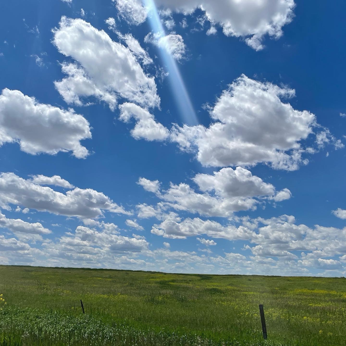
Cumulus
Did you ever think about how much a cloud weighs? According to USGS, an average 1 km by 1 km cumulus cloud weighs around 1 MILLION pounds! Lucky for us, when clouds fall, they tend to be in the form of rain or snow. Whew! Resembling giant cotton balls in the sky, cumulus clouds are generally associated with good weather. However, if they build upward and darken at their bottom, that can indicate they are growing into something stormier.
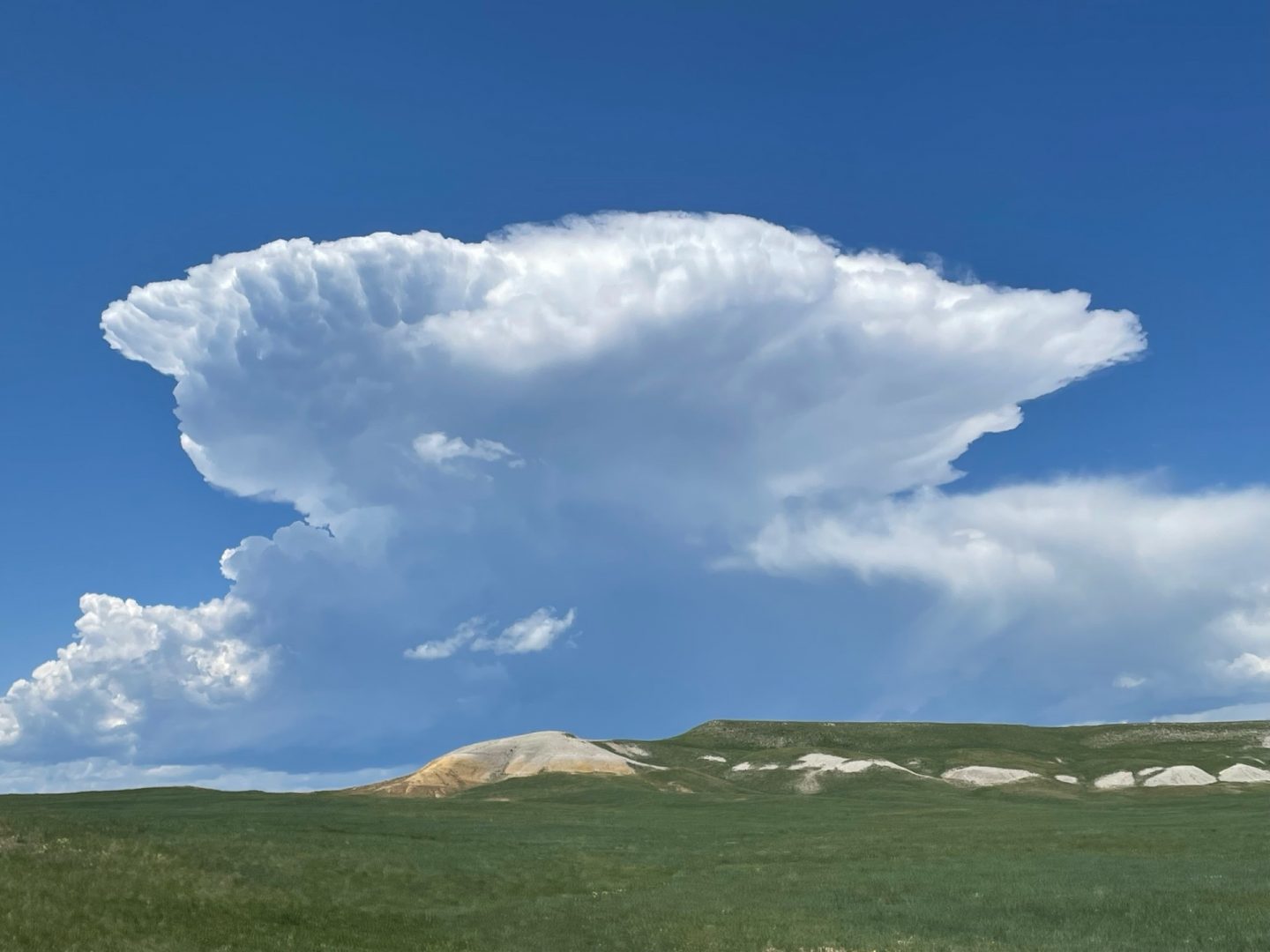
Cumulonimbus
This is the big one — the giant. These powerful storm clouds are capable of producing thunder, lightning, hail and tornadoes. From a distance, you may be able to see the anvil shape spreading out from the top of the cloud.
Mamma
Known as mammatus clouds — or less formally as “booby” clouds — these clouds were named for their resemblance to udders. These lobed clouds are a distinct sight in the sky. They are often associated with stormy weather, as the most notable displays are often at the bottom of huge cumulonimbus storm clouds. However, these clouds generally form at the end of storms, so it typically means the storm has passed.
There are plenty of other cloud shapes to learn about! But the most fun are probably the shapes and stories that you can imagine.