Nebraskaland Magazine
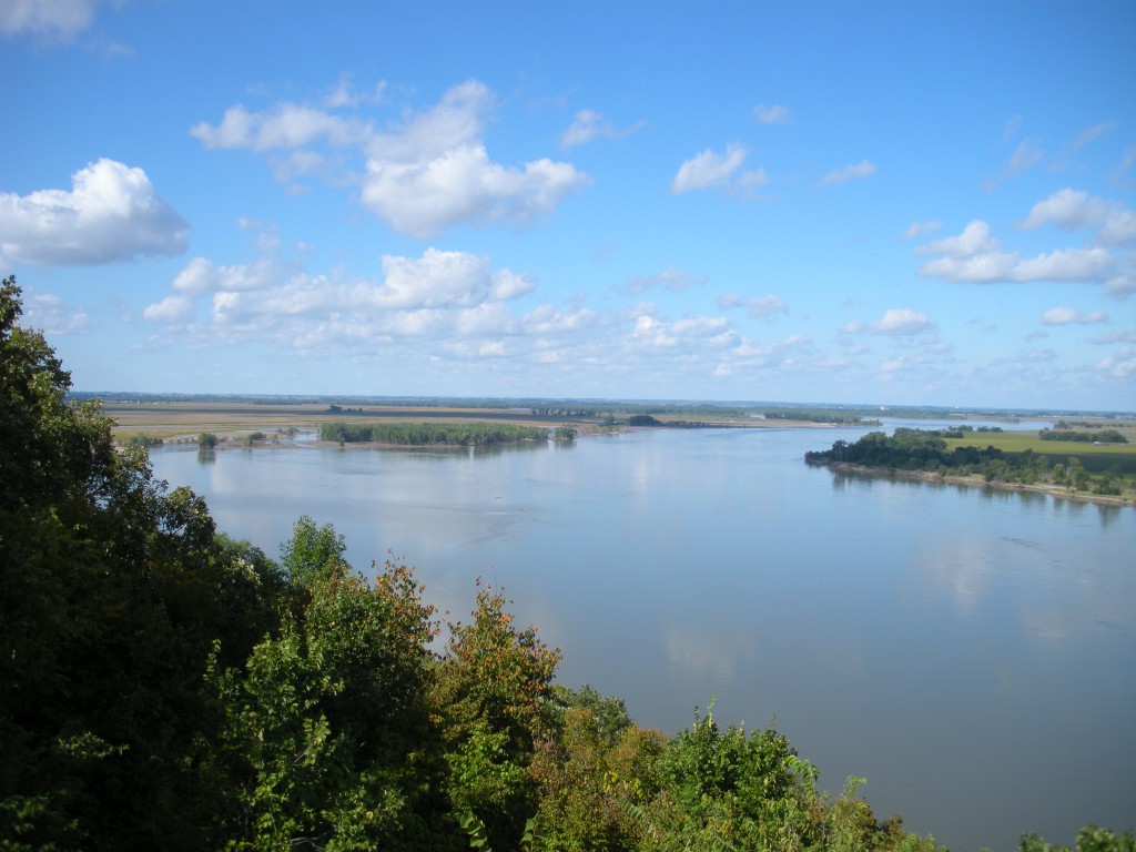
I got this update on Missouri River flows recently:
NEWS RELEASE
For Immediate Release: June 11, 2013Contact: U.S. Army Corps of Engineers, Northwestern Division
Phone: (402) 995-2420 (888) 835-5971
E-mail: Monique.l.farmer@usace.army.mil
Omaha, Neb. — Despite wetter-than-normal conditions across much of the Missouri River basin during May, drought persists across much of the region and mainstem reservoir levels remain below normal.“Even though rainfall was two to three times normal in eastern Montana, and western North Dakota during May, runoff in the upper basin was only slightly above normal,” said Jody Farhat, Chief of the Missouri River Water Management Division.”The basin continues to recover from the 2012 drought and reservoir levels in Fort Peck, Garrison and Oahe remain 6 to 9 feet below the desired operating levels.”
Runoff into the Missouri River basin above Sioux City, Iowa for the month of May was 106 percent of normal.Based on the current soil moisture and mountain snowpack conditions, the 2013 runoff forecast inched to 21.3 million acre-feet, 84 percent of normal.”The above normal rainfall improved soil moisture conditions, but did not eliminate drought in the basin,” said Farhat.
Heavy rain also fell across much of the lower basin resulting in increased flows on many of the tributaries below the system of reservoirs.”Gavins Point releases were reduced from 24,000 cubic feet per second (cfs) to 12,000 cfs in late May and early June as part of our normal flood risk reduction measures,” said Farhat.”Thunderstorms can cause localized flooding even during droughts, so flood risk reduction remains a primary consideration as we progress through 2013.”
The Corps will continue to monitor basin conditions and fine tune the regulation of the reservoir system based on the most up-to-date information.
“Reductions in releases for flood risk reduction also allow us to conserve water in the reservoirs,” she added.
As part of the Corps’ drought conservation measures, minimum service flow support is being provided for the first part of the navigation season, which runs through the end of June. Releases out of Gavins Point Dam are expected to increase to 23,000 cfs and average that level through the end of the month. The level of flow support for the second half of the navigation season and the season length will be determined following the system storage check on July 1. “Our latest forecast shows a slight improvement to the navigation service level is possible for the second half of the navigation season as well as a full 8-month season,” said Farhat.
Minimum-service flow targets range from 25,000 cfs at Sioux City, Iowa to 35,000 cfs at Kansas City, Missouri.Minimum service flow support is generally sufficient to provide a navigation channel that is 8 feet deep by 200 feet wide although challenges may exist in localized reaches.
Gavins Point releases during the winter of 2013-2014 are forecast to be at the minimum rate of 12,000 cfs.Reduced support to navigation and low winter releases are the two primary drought conservation measures used to regulate the mainstem reservoir system.These measures help ensure the reservoir system can continue to serve the authorized purposes during an extended period of drought.
According to information from the Natural Resources Conservation Service, the mountain snowpack peaked in both the reach above Fort Peck and the reach from Fort Peck to Garrison at about 95 percent of normal.Approximately 25 percent of the peak snow accumulation remains in the mountains.
View mountain snowpack graphic here: http://www.nwd-mr.usace.army.mil/rcc/reports/snow.pdf
Reservoir Forecasts
Gavins Point releases averaged 18,300 cfs during the month of May.Releases were reduced from 24,000 cfs to 12,000 cfs in late May due to high tributary flows below the system of reservoirs.Releases were stepped up to 18,000 cfs in early June.Releases are expected to reach 23,000 cfs in mid-June to prevent the endangered least tern and threatened piping plover from nesting on low sandbars that would be flooded later this summer when higher releases are needed to provide navigation flows.The nesting season runs from May to late August.The reservoir behind Gavins Point Dam ended April at elevation 1206.2 feet msl. The reservoir will remain near elevation 1206 feet msl during June.
Fort Randall releases ranged from 5,000 cfs to 23,000 cfs during May, averaging 15,700 cfs.Fort Randall releases will be adjusted during June as necessary to maintain the desired elevation at Gavins Point. The reservoir ended May at elevation 1357.6 feet msl, up 1.6 feet during the month. It is expected to gradually fall to near elevation 1355 feet msl by the end of the June.
Big Bend releases averaged 15,300 cfs during the month of May. They are expected to average near 13,000 cfs this month. The reservoir will remain near its normal elevation of 1420 feet msl during June.
Oahe releases averaged 15,900 cfs during the month of May. Releases are expected to average near 12,000 cfs this month. The reservoir ended May at elevation 1600.1 feet msl, up 2.6 feet during the month. The reservoir is expected to rise about 2.5 feet during the month of June.
Garrison releases averaged 20,200 cfs in May.Releases were reduced from 20,500 cfs to 20,000 cfs in early June.Garrison ended the month at elevation 1829.6 feet msl, up 1.4 feet from the previous month. It is expected to rise nearly 3 feet during June.
Fort Peck releases averaged 8,000 cfs in May.Releases will remain near that rate in June. The reservoir ended May at elevation 2223.4 feet msl, up 0.7 foot from the previous month. The reservoir is forecast to rise 2 to 3 feet during June.
The forecast reservoir releases and elevations discussed above should not be assumed to be definitive. Additional precipitation or lack of precipitation in the basin could cause adjustments to the reservoir release rates.
The six mainstem power plants generated 608 million kilowatt hours of electricity in May. Typical energy generation for the month of May is 687 million kWh. The power plants are projected to generate 7.6 billion kWh of electricity this year, compared to the normal of 10 billion kWh.
To view the detailed three-week release forecast for the mainstem dams, go to: http://www.nwd-mr.usace.army.mil/rcc/reports/twout.html.
If you fish rivers any you know that water flows have a huge impact on fish movement, location and behavior. The news release I just copied here is a couple of weeks old I realize, but for those of you who fish our Missouri River it should give you some valuable information for what you can expect the rest of this summer.
What I found most useful about that whole news release was the link provided at the end! Make sure you bookmark this and then you should have a much better idea of what to expect anytime you fish the river, http://www.nwd-mr.usace.army.mil/rcc/reports/twout.html !